Over on GitHub, Jean-Michel Friedt has uploaded new code, results, and findings from one of his latest experiments with passive radar. A simple passive radar system uses two coherent receive channels and two antennas. One antenna receives a clean reference signal from an illuminator of opportunity, such as an FM or TV transmitter, while the other surveillance antenna receives echoes from the area containing targets. By correlating the surveillance signal with the reference signal over different delays and Doppler shifts, the system produces a range-Doppler map showing potential targets.
The novel thing about Friedt's recent work is that the illuminator is a moving L/S-Band satellite in space. The illuminator used is the polar-orbiting NISAR, a NASA-ISRO satellite designed for synthetic aperture radar (SAR). SAR satellites create detailed images of Earth by sending radar pulses to the ground and combining the returning echoes collected as the satellite moves, effectively simulating a much larger antenna.
Part of the trouble with using NISAR as an illuminator is predicting when it will be illuminating your current location. Friedt's GitHub readme explains how the software does illumination prediction.
NISAR emits chirp signals at 20 MHz bandwidth in the L and S-band, so a wideband SDR is required to get the full resolution. In his setup, Friedt used an Ettus B210 or Enjoy Digital M2SDR SDR, with two active GNSS antennas.
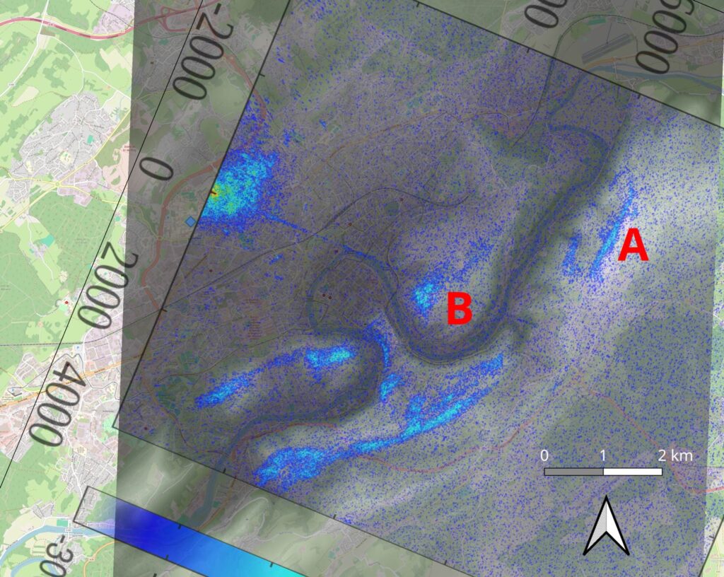
The results show that he was able to successfully receive reflections of the satellite signal from the ground, transform the range-doppler data into map coordinates, and overlay them on a map.
