
On Thursday, the Israel Defense Forces (IDF) announced the death of Hamas leader Yah 2024-10-18 06:26:13 Author: www.bellingcat.com(查看原文) 阅读量:19 收藏
On Thursday, the Israel Defense Forces (IDF) announced the death of Hamas leader Yahya Sinwar during an operation in southern Gaza.
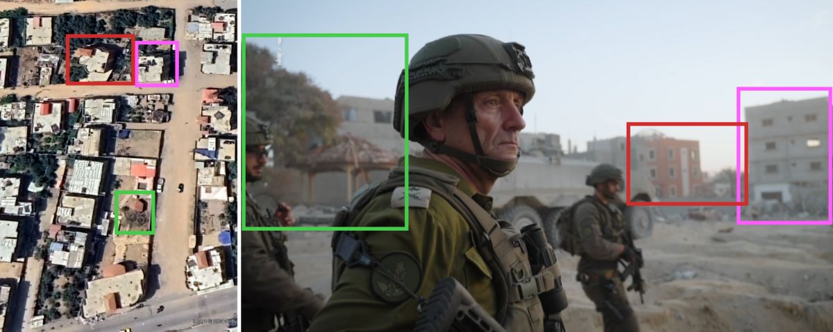
As part of its announcement, the IDF’s media channel on Telegram shared images and video shot from the location where they said Sinwar was killed.
Using the IDF video as well as the images shared by the IDF in their Telegram post and videos geolocated previously by volunteers, it is possible to geolocate the house to Gaza’s Tal as-Sutlan area at 31.3055, 34.2467.
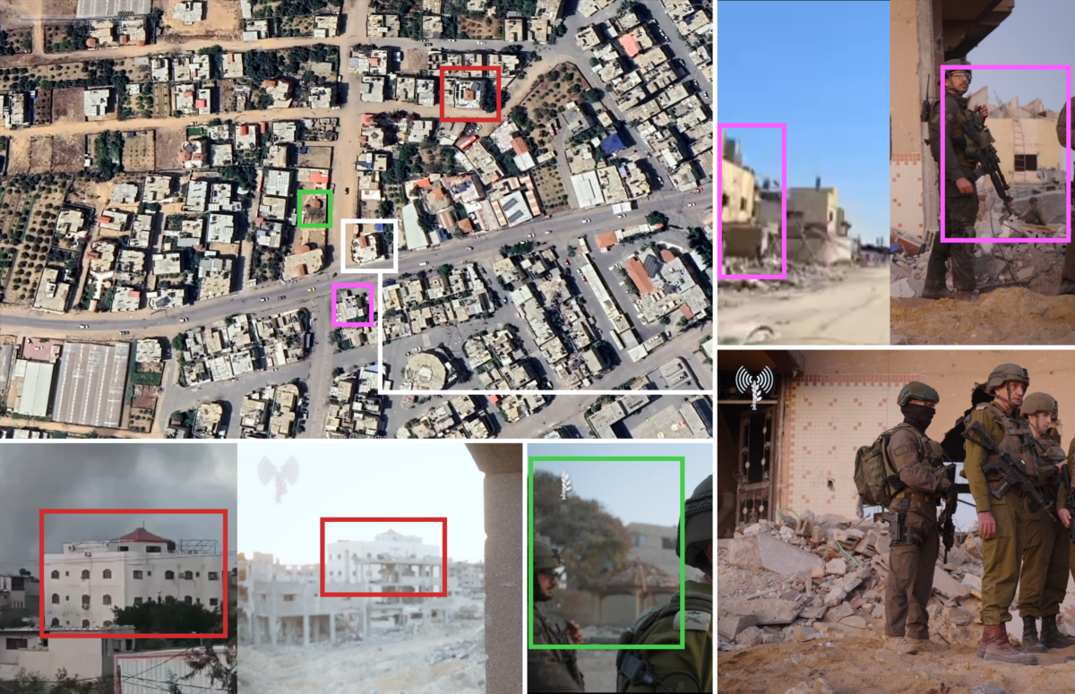
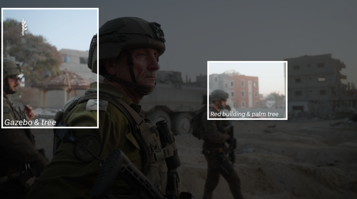
The visuals offer a few clues for where to look when geolocating the house visible in the IDF videos and images. The main ones are a gazebo with a tree next to it and a red building in the background with a palm tree next to it.
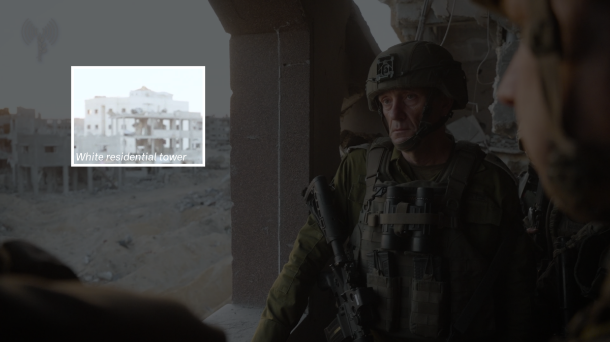
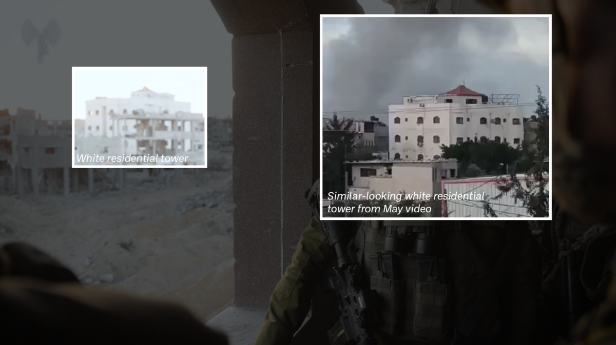
A white residential-looking tower with a triangular orange roof is also visible in the footage.
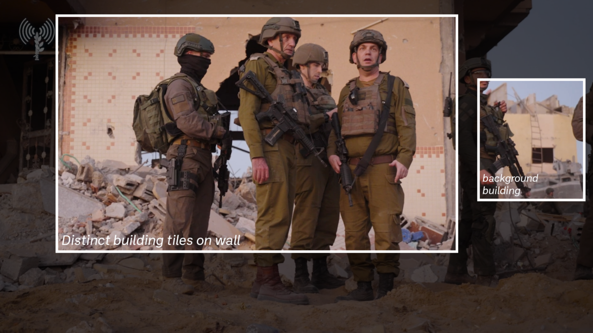
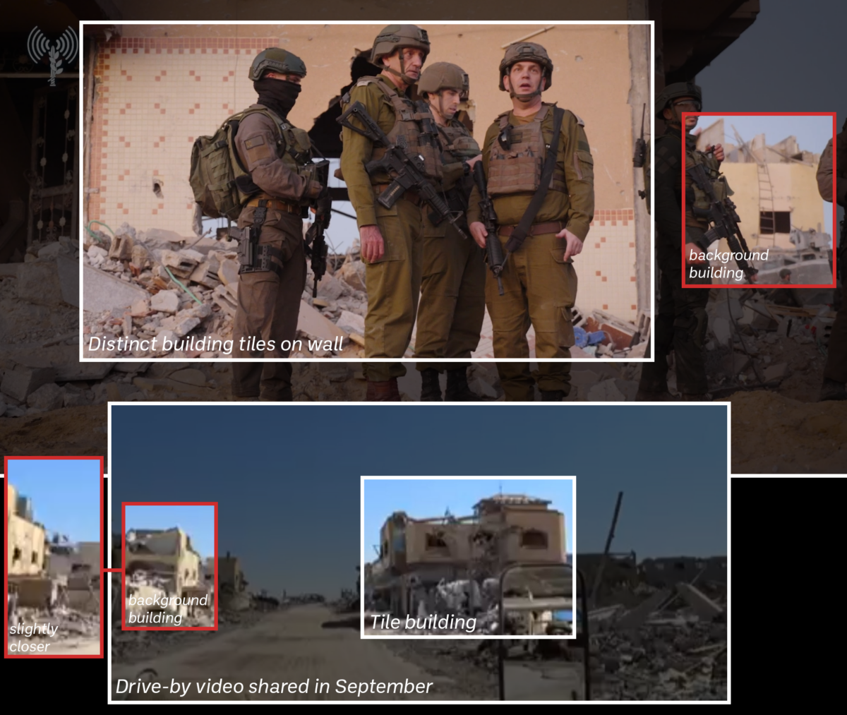
Finally, a building appears to be flanking a house that has a distinct set of tiles on the wall.
These tiles were also visible in a photo shared by Times of Israel military correspondent Mannie Fabian. These photos showed a body bag that it was stated contained Sinwar’s corpse.
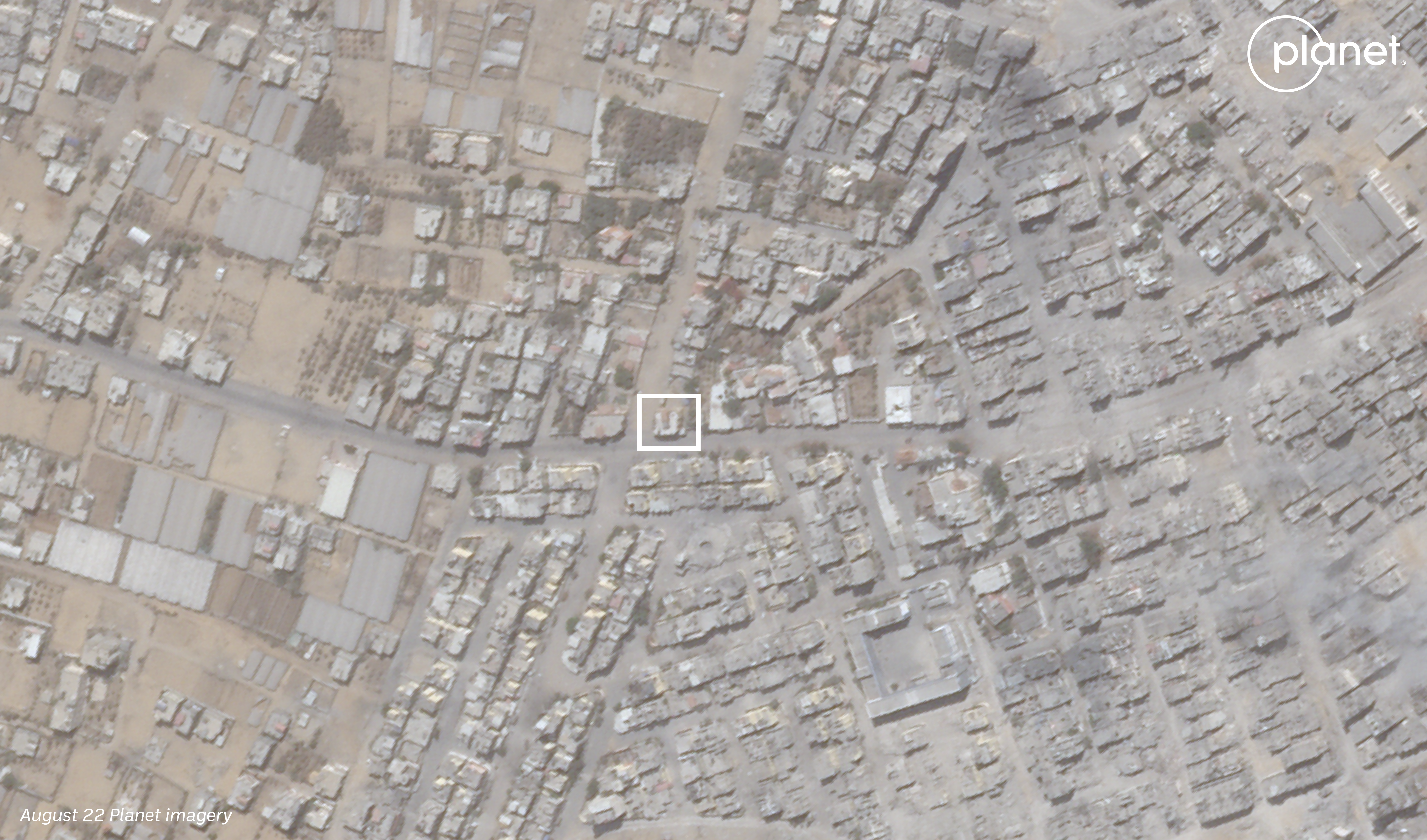
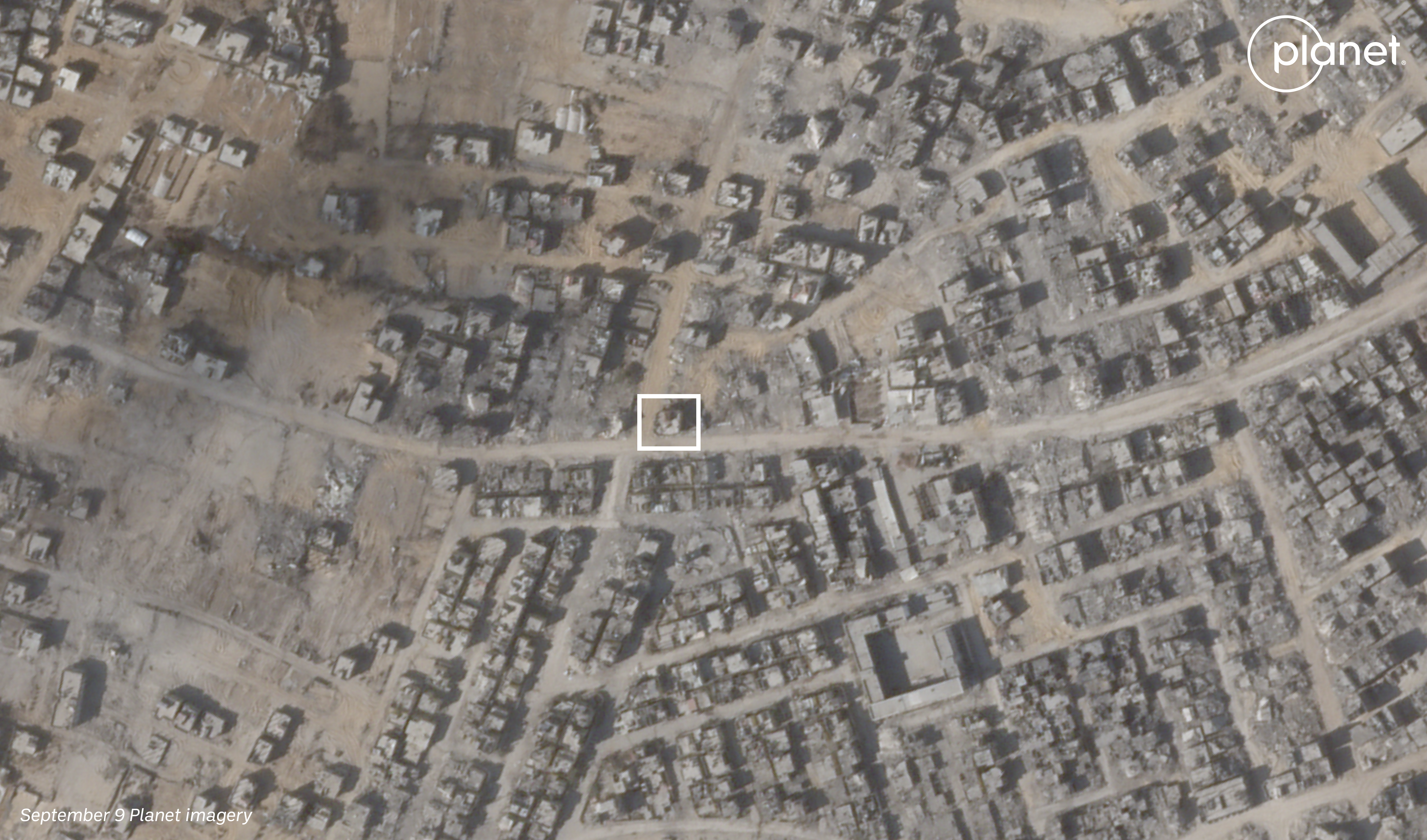
There were initial reports suggesting the incident that led to Sinwar’s death took place in Rafah’s Tal as-Sultan neighbourhood. We therefore began to search this area for some of the visual markers identified above.
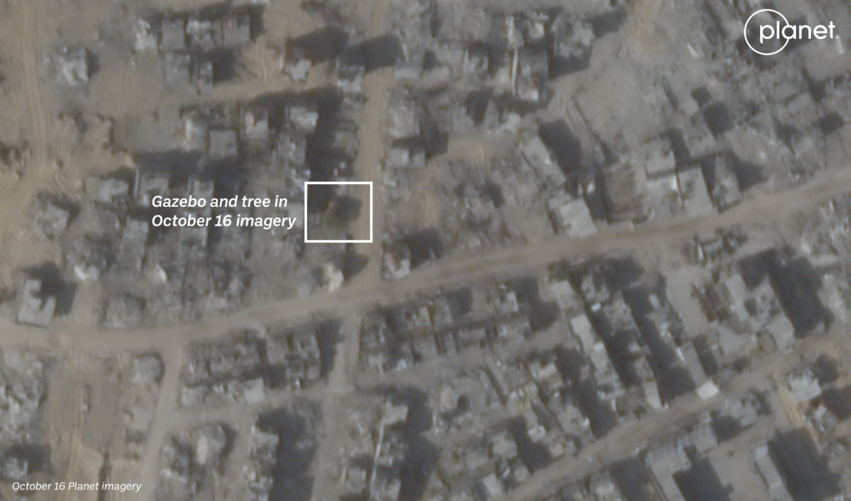
The easiest of these to find was the gazebo as it both had a tree next to it and a distinctive hexagonal shaped roof.
One such area with both a gazebo and tree was located at 31.3051, 34.2466 using recent SkySat imagery from Planet Labs PBC.
With an area of interest now further narrowed down, we began to search for previously-verified imagery or videos of this neighbourhood using an interactive map provided by Geoconfirmed, a community-based geolocating platform.
The Geoconfirmed map contained two videos of this area that proved useful. The first was from late May, showing a view from near Rafah’s Emirati Hospital. In the first few seconds of the video, a white residential tower that appears to match the one in the background of the IDF photo can be seen. The tower, located at 31.3055, 34.2455 was geolocated by Geoconfirmed volunteer @KJ_X23.
Another video that provides a clue is a drive-by video filmed by an IDF soldier and shared online in September. The route, geolocated by Geoconfirmed volunteer @NemoAnno, passes right by the location near the gazebo.
Whatsmore, the building visible in the background of the aforementioned photo that showed IDF soldiers in front of a distinct set of tiles can be seen in the footage (at 1:47 timestamp) geolocated by Geoconfirmed.
In the video, you can see the building on the left side of the screen as the camera pans to look at the house where Sinwar would ultimately be found. This house has a yellow and white pattern that can be seen in both the Telegram video and image of IDF soldiers.
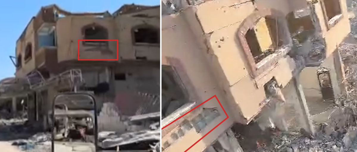
The identification of this building was further validated by another video later released by the IDF claiming to show Sinwar before he was killed.
In the first second of the video, the exterior of the building is visible. Compared with the video of the IDF drive-by from September, we can match part of the damage that was still visible in the more recent video. The shape of the windows and colour of the building also match.
While there was no reference imagery of the red building and tree previously detailed, the location lines up from the perspective of the camera when looking south from the building where Sinawar was killed.
Both can be seen behind the gazebo and tree in the IDF video as well as in Google Earth imagery.
All of these steps helped us establish the house where Sinwar’s body was found. It’s not clear from IDF statements or media reporting how long Sinwar and the other Hamas fighters killed were in the building.
Based on Planet Labs imagery, it’s possible to see that the IDF started operating in the area of the house in late August and early September given that was when buildings and vegetation in the vicinity of the house began to be destroyed.
Bellingcat is a non-profit and the ability to carry out our work is dependent on the kind support of individual donors. If you would like to support our work, you can do so here. You can also subscribe to our Patreon channel here. Subscribe to our Newsletter and follow us on Twitter here and Mastodon here.
如有侵权请联系:admin#unsafe.sh