A few weeks ago we posted about how @ZSztanga and @aang254 were able to record and decode Global Area Cover (GAC) images from polar orbiting NOAA weather satellites. GAC images are low resolution, but they provide an image of the entire orbit. The GAC signal is only transmitted over the USA.
A week earlier than @ZSztanga and @aang254 above decoded GAC, another software called LeanHRPT by @Xerbo also implemented a GAC decoder. LeanHRPT is available on Windows, Linux and MacOS, and ready to download binaries are available on the releases page. You'll need the LeanHRPT demodulator too, in order to initially demodulate the signal.
Crops of the US West Coast and Cyclone Batsirai from a single pass of NOAA-19 at 1702.5 MHz. NOAA satellites use a HRPT-like "GAC" broadcast to play back stored image data, support coming to LeanHRPT soon! pic.twitter.com/cTdRBzDbnd
— Xerbo (@Xerbo10) February 5, 2022
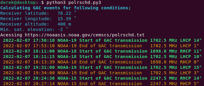
@Xerbo also notes that @dereksgc has also released a useful Python script for predicting NOAA GAC transmissions. It shows when a particular NOAA satellite will begin and end their GAC transmission, as well as the frequency, polarization and elevation of the satellite.
